


Analysis Area: 18 Cities and Counties in Gyeongsangnam-do
Analysis Structure: Comparison of the Eastern Industrial/Urban Axis and the Western Hub/Agricultural/Fishing Village Axis
Eastern Major Axis: Living area connecting Changwon, Gimhae, Yangsan, and Busan/Ulsan
Western Major Axis: Living area connecting Jinju/Sacheon, and Geochang, Hamyang, Sancheong, Hapcheon, Hadong, and Namhae
Correction Zone: Geoje, Tongyeong, and Goseong are classified as the South Coast Industrial/Living Area and are subject to separate cross-assessment
Golden Time Type: Western Growth-node Opportunity + Spatial Irreversibility Risk
Version: Regional AX Golden Time Intelligence v3.2 Enhanced Criteria Reference
Date: 2026.08.28
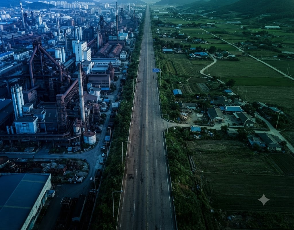
As of November 2025, the population of Gyeongnam, including foreigners, is approximately 3.32 million, but the National Data Center projects that it will decline to 2.92 million by around 2040. The 11 areas in Gyeongnam designated by the government as experiencing population decline are Miryang City and the counties of Geochang, Goseong, Namhae, Sancheong, Uiryeong, Changnyeong, Hadong, Haman, Hamyang, and Hapcheon; these encompass most of the western and inland regions, excluding Jinju and Sacheon, as well as parts of the central and southern coastal areas. The population decline is not merely driven by a single east-west boundary but is structured to be concentrated outside the commuting zones of major cities and industrial hubs. Evidence combining population by administrative district with actual travel times for commuting, medical services, and education is lacking. If living services outside these hubs are reduced between 2026 and 2028, the irreversibility will increase, where population outflow leads to service closures, which in turn further exacerbates outflow. The east-west disparity in Gyeongnam is not merely a difference in population, but a disparity in living zones that is being reshaped based on travel times to these hubs. ( Yonhap News , Gyeongnam Domin Ilbo )
Gyeongnam’s GRDP for 2024 reached 151.2 trillion won, an 8.5% increase from the previous year that ranked third nationwide, and its economic growth rate of 3.2% surpassed the national average of 2.0%. However, the rebound in the manufacturing sector is concentrated in existing industrial axes such as Changwon, Gimhae, Yangsan, and Geoje, as well as the Sacheon aerospace hub. There is no evidence linking the province's overall economic growth with the income and service accessibility of residents in cities and counties. If the boom in the defense, shipbuilding, and aerospace industries between 2026 and 2028 accrues first to hub companies and cities, the living spheres of western counties and hinterland regions will shrink, even amidst the rise in Gyeongnam’s overall GRDP. While the recovery of Gyeongnam’s economic scale has been confirmed, this cannot be used as evidence to alleviate regional disparities. ( Gyeongnam GRDP Report , National Data Center Regional Income )
In the east, Yangsan Pusan National University Hospital and Changwon Gyeongsang National University Hospital are adjacent to the tertiary medical, educational, and consumer markets of Busan and Ulsan; however, in the west, demand from the extensive Jinju, Sacheon, Namhae, Hadong, and Sancheong regions is concentrated at Jinju Gyeongsang National University Hospital. Gyeongnam has proposed a system to secure general hospital-level responsible medical institutions across five medical service zones—Changwon, Gimhae, Jinju, Tongyeong, and Geochang—and the Western Medical Center aims to open in 2028. While changes reflecting an institutional recognition of disparities in living areas are evident, a time gap remains between current medical accessibility and supply after 2028. If population aging and medical personnel shortages proceed first over the next two to three years, access to emergency care, childbirth, and inpatient services will further deteriorate before the facilities open. Currently, the "Golden Time" is Western Growth-node Opportunity + Spatial Irreversibility Risk. ( Yonhap News , Analysis of Medical Disparities in Gyeongnam )
Changwon, Gimhae, and Yangsan in eastern Gyeongsangnam-do are part of a population, industrial, residential, educational, and consumer market that is continuous with Busan and Ulsan. Changwon possesses infrastructure for machinery, defense, and nuclear power; Gimhae for machinery and automotive parts; and Yangsan for manufacturing, logistics, and medical services; while they are close to Busan Port, Gimhae Airport, and the Busan consumer market. Although a metropolitan living area utilizing the functions of a large city outside administrative boundaries has already been formed, the local attribution of commuting, medical, and educational consumption that crosses city and provincial borders is not fully accounted for. If accessibility to Busan improves further between 2026 and 2028, a dual structure will be reinforced in eastern Gyeongsangnam-do where high-value consumption and talent are drawn to Busan while the region maintains its population. Although eastern Gyeongsangnam-do is a region with many daily living functions, it is not a region where all functions are completed within the province.
Western Gyeongnam features Jinju as a center for education, medical services, and administration, and Sacheon as an aerospace manufacturing hub. While the establishment of the Korea Aerospace Agency and the Gyeongnam Aerospace Industrial Complex have formed national-level growth centers in the west, there is a lack of evidence that this has expanded into a single industrial and living sphere extending to Geochang, Hamyang, Sancheong, Hapcheon, Hadong, and Namhae. A gap remains between the growth of Jinju and Sacheon and the accessibility of the western county regions. If aerospace investment proceeds primarily through companies and research institutions from 2026 to 2028, the disparity between Jinju and Sacheon and the county regions will widen even within the western region. Western Gyeongnam is not a single underdeveloped zone, but rather an internally polarized region where growth centers and shrinking areas coexist.
Although Tongyeong, Geoje, and Goseong are geographically classified as western or southern, they form an independent South Coast economic zone centered on shipbuilding, fisheries, and tourism. While Geoje’s GRDP ranks fourth within the province after Changwon, Gimhae, and Yangsan, it is highly volatile in the shipbuilding industry; conversely, Tongyeong and Goseong experience shifts in industry, medical services, and transportation to Geoje, Jinju, or Changwon. It is difficult to simultaneously explain the industrial intensity and the vulnerability of living services along the South Coast solely through the East-West dichotomy. If this dichotomous distribution persists for two to three years, Geoje’s industrial boom is counted as a strength, while the gap in living spheres in Tongyeong and Goseong is omitted as a separate risk. It is more accurate to assess Gyeongnam’s actual spatial structure as consisting of at least five functional living zones rather than just two East-West regions.
In 2022, Changwon, Gimhae, Yangsan, and Geoje formed the top tier for city and county GRDP. While Jinju had a relatively large total GRDP, its per capita GRDP was lower compared to manufacturing cities. This structure indicates that economic indicators differ between cities where production facilities are concentrated and those where education, medical, and administrative services are concentrated. A "gap" is confirmed where GRDP is equated with resident income or living standards. If the manufacturing boom persists from 2026 to 2028, the gap between the GRDP of production hubs and the cost of living, housing, and public demand of service hubs will widen further. The East-West disparity cannot be determined solely by the total GRDP; functional differences between production sites and residential areas must be separated. ( Analysis of Gyeongnam City/County GRDP and Jinju Per Capita GRDP )
Eastern Gyeongnam is adjacent to Busan and Ulsan, allowing for wide-area access to businesses, universities, hospitals, and consumer facilities; however, the opening of the Bujeon-Masan double-track railway, originally scheduled for 2021, has been significantly delayed from a 99% completion rate following a ground subsidence accident. As the entire section is not expected to open even by 2026, the formation of a railway living zone encompassing Busan, Gimhae, and Changwon has been delayed. This highlights a gap between industrial and population concentration and the completion of regional transportation infrastructure. If the opening delays persist between 2026 and 2028, road congestion and commuting costs will constrain even the productivity of the eastern growth axis. Eastern Gyeongnam is not a region with established infrastructure but rather an overcrowded living zone where demand has grown first while railway connectivity has lagged behind. ( Yonhap News )
Construction of the Southern Inland Railway, connecting western Gyeongnam to the Seoul metropolitan area, began in 2026. With a total project cost of 7.0974 trillion won, the 174.6 km line from Gimcheon to Geoje aims for opening in 2031. While improvements to railway accessibility in the west have entered the final stage of confirmation, the actual opening is five years behind the current "Golden Time." The opening target was delayed from the original 2027 to 2031, and with increased project costs, the time gap has already become a reality. If youth, businesses, and services leave first between 2026 and 2028, the influx effect after the railway opens will diminish. Although transportation opportunities in western Gyeongnam are significant, operational effects sufficient to alleviate the current disparity in living areas have not yet materialized. ( Newsis , Gyeongnam Shinmun )
Living services in regions experiencing population decline are shifting from a self-contained model based on administrative boundaries to a wide-area living zone model where multiple cities and counties share hospitals, transportation, education, and cultural facilities. South Gyeongsang Province has also begun formulating urban plans centered on wide-area living zones, grouping three to six adjacent cities and counties, with a target date of 2026. Although the policy unit has shifted from administrative boundaries to functional living zones, data confirming these zones based on actual commuting, medical treatment, schooling, and consumption flows has not yet been released. If these zones remain merely theoretical divisions for two to three years, facility duplication and service blind spots will persist. South Gyeongsang Province has only declared the transition to living zones; it has not yet reached the stage of verifying resource allocation by zone. ( Yonhap News )
Industrial competition is shifting from factory locations to the time it takes for talent to commute or change jobs, and for companies to access universities, hospitals, housing, and culture. While Eastern Gyeongnam offers access to large labor markets including Busan and Ulsan, the number of companies and specialized jobs within commuting distance of the Jinju and Sacheon hubs in the west is rapidly decreasing. There is no evidence linking the area of industrial complexes with the actual size of the labor market within a 60-minute radius. Even with the expansion of remote work and automation between 2026 and 2028, it is highly likely that personnel in research, design, and collaboration will concentrate further in hub cities. The unit of industrial disparity has shifted from the number of companies to the diversity of jobs reachable within 60 minutes.
Medical, educational, and cultural services exhibit a cyclical structure where demand decreases as the population declines, and a reduction in services accelerates the exodus of families and young people. Most of the 11 population-declining regions in Gyeongnam face the simultaneous risks of population aging and a reduction in essential services. However, there is a lack of evidence demonstrating the chronological relationship between facility closures, workforce reductions, and population migration. If any of the following services—such as childbirth, emergency care, private academies, or cultural services—falls below a critical threshold over a period of two to three years, household-level migration accelerates. Disparities in living areas do not expand linearly but undergo an irreversible transformation following the loss of specific services.
The Korea Aerospace Administration and the aerospace industries in Sacheon and Jinju are creating a new growth axis in western Gyeongnam. However, even if industrial hubs grow, if residential, medical, international education, culture, and transportation infrastructure do not expand simultaneously, skilled professionals will not settle in Jinju or Sacheon but will instead choose to stay during the week or commute from outside. An Evidence Gap remains between corporate investment and the settlement of the resident population. Once the initial site selection for the aerospace ecosystem is finalized between 2026 and 2028, a structure will become entrenched where research and service functions remain in the Seoul metropolitan area or the eastern region. Western Gyeongnam is currently at a stage where the localization of industrial opportunities is determined by the readiness of the living area.
Gyeongnam has proposed a structure that divides its 18 cities and counties into five medical service zones—Changwon, Gimhae, Jinju, Tongyeong, and Geochang—and secures responsible medical institutions at the level of general hospitals for each zone. This confirms a shift in reorganizing medical zones based on accessibility to medical care rather than administrative boundaries. However, the Western Medical Center in the Jinju zone is targeted to open in 2028, while the current levels of fulfillment regarding staffing, beds, emergency services, and delivery functions vary among zones such as Geochang. A time gap remains between 2026 and 2028 to accommodate the increase in medical demand and the shortage of specialized personnel prior to facility expansion. Although the design of the medical zones has been carried out, the current completeness of all zones has not yet been secured.
Gyeongnam has planned 70 projects totaling 796.8 billion won for 11 population-declining regions by 2026, comprising 40.2 billion won from the Local Extinction Response Fund, 347.3 billion won in state funds, 373 billion won in local funds, and 5 billion won in private investment. While fiscal input has expanded, there is currently no evidence linking improvements in resident population, access to medical care, commuting time, and regional income to individual projects. A gap exists between the scale of funding and the sustainability of living areas. If the number of projects and execution amounts are maintained as performance outcomes for two to three years, they will accumulate as completed projects even if the rate of population decline does not slow down. The current response is in the fiscal input phase, not the spatial outcome verification phase. ( Gyeongnam Population Policy Implementation Plan )
Discussions regarding the Southern Inland Railway, the Bujeon-Masan Double-Track Railway, the Jinju-Sacheon road network, and metropolitan transportation for Busan, Ulsan, and Gyeongnam are proceeding in parallel. While these transportation networks aim to address both the overconnectivity in the east and the lack of accessibility in the west, the opening dates for each project are dispersed and scheduled for after 2026. The runtime linking the progress of transportation projects with the actual expansion of commuting, medical, and educational zones has not been verified. If only pre-opening expectations are reflected during the period of 2026–2028, corporate and residential locations will be determined ahead of actual accessibility. The transportation response is currently at the stage of large-scale projects, not the stage of operational living zones.
In the Seoul Metropolitan Area, railways, roads, hospitals, universities, and cultural facilities transcend administrative boundaries to function as a single labor and living market. Although Gyeongnam ranks among the top in the nation for manufacturing GRDP and population, the commuting, education, and medical systems of Busan, Ulsan, and Gyeongnam are fragmented in terms of administration, fares, routes, and data. A gap exists between economic scale and the degree of integration of the metropolitan living area. If the concentration of metropolitan transportation and medical services in the Seoul Metropolitan Area intensifies further between 2026 and 2028, Gyeongnam's industrial scale will not translate into convenience of living within the same region. While Gyeongnam is a large region in terms of economic scale, its degree of functional living area integration is lower than that of the Seoul Metropolitan Area.
Eastern Gyeongnam offers a wide range of lifestyle options due to its access to the metropolitan services of Busan and Ulsan, but some consumption, medical services, and education flow out of the province. Western Gyeongnam, on the other hand, relies more heavily on the hub functions of Jinju due to its low accessibility to external metropolitan cities. The East exhibits a distinct gap characterized by external functional dependence, while the West relies on a single hub. Applying the same balanced development measures for two to three years will fail to simultaneously resolve the outflow in the East and the gap in the West. The East is assessed as facing a risk of local attrition amidst superior accessibility, while the West faces an accessibility risk amidst the potential for local attrition.
Gyeongnam ranks third nationwide with a GRDP of 151.2 trillion won, yet 11 cities and counties within the province are experiencing population decline. This represents a typical structure where the scale of the metropolitan economy and the sustainability of basic living areas do not move in the same direction. A gap is identified where the overall growth of the province cannot be used as a proxy variable for balanced development. As the manufacturing boom persists from 2026 to 2028, the statistical illusion of simultaneous economic indicators and shrinking living areas intensifies. Gyeongnam currently occupies a dual structure: it is a growth region while possessing numerous shrinking living areas.
Although Gyeongnam's GRDP in 2024 increased by 8.5% compared to the previous year, 11 out of its 18 cities and counties have been designated as areas of population decline. This serves as evidence that increased production does not automatically translate into the maintenance of population and services. There is a lack of data linking the value added of growth industries with labor income and business revenue in areas of population decline. If GRDP and population move in opposite directions for two to three years, the province's overall growth rate reflects the collapse of living areas with a delay. Gyeongnam is currently at a stage where economic growth and spatial contraction are proceeding simultaneously.
The population of Gyeongnam is projected to decrease by 400,000, or approximately 12%, from about 3.32 million in 2025 to about 2.92 million in 2040. It is highly likely that this decline will not be distributed evenly across all regions but will first concentrate in living areas with poor accessibility to industry, universities, and hospitals. There is no evidence combining population projections by city and county with critical demand for essential services. If operating standards for schools, hospitals, and public transportation for 2026–2028 are maintained based on current population figures, closures will occur in a chain reaction in areas experiencing actual decline. The temporal risk for Gyeongnam lies in the fact that critical services will collapse before 2030, rather than the projected population size in 2040.
The Southern Inland Railway is a 174.6 km project worth 7.0974 trillion won, but its opening is targeted for 2031. The Western Medical Center aims to open in 2028. The key transportation and medical infrastructures of the western living area will become operational two and five years from now, respectively. There is a lack of evidence to offset the outflow of population, businesses, and medical personnel prior to the completion of these infrastructures. The period from 2026 to 2028 is a gap during which only risks accumulate before any effects materialize. While investment in Western Gyeongnam has been confirmed, the risk of delay has not been resolved.
Construction on the Bujeon-Masan double-track railway, covering a 51.1 km section, began in 2014 and was scheduled for completion in 2021, but the entire line was not fully opened until 2026. Even facilities with a 99% completion rate failed to generate synergistic effects due to issues regarding accidents, liability, and safety verification. A gap exists between the construction progress rate and actual usability. If partial and full openings are delayed again for two to three years, the formation of a metropolitan commuter zone encompassing Busan, Gimhae, and Changwon will also be delayed. The value of transportation infrastructure is judged solely by the reduction in actual travel time, not by investment amounts or completion rates.
The biggest gap is that while Gyeongnam possesses data by administrative district, it fails to adequately connect it with data regarding actual living areas . Residents work, receive medical treatment, and consume in cities or counties different from their places of residence, yet population, GRDP, hospital beds, schools, and cultural facilities are tallied based on their locations. Consequently, the flows between production sites and users, and between residences and consumption sites, are separated. If the 2026–2028 Metropolitan Living Area Plan is finalized without addressing these flows, the method of resource allocation will remain the same even if boundaries change. Gyeongnam's spatial readiness gap lies more in the invisibility of daily life flows than in a lack of facilities.
The second gap lies in the diffusion between the hub and the hinterland. The aerospace industry in Jinju and Sacheon, the manufacturing industry in Changwon, Gimhae, and Yangsan, and the shipbuilding industry in Geoje possess national-level industrial infrastructure. However, the rate at which the hiring, procurement, consumption, and housing activities of hub companies have spread to nearby county areas has not been confirmed. A gap remains between the growth of industrial hubs and the maintenance of the hinterland living area. If growth functions are completed within the hub city over a period of two to three years, adjacent county areas shrink from serving as commuting hinterlands to becoming mere sources of population supply. Industrial hubs exist, but the runtime for the diffusion of growth into the living area is incomplete.
The third gap is the minimum standard for accessibility. Although Gyeongnam has proposed plans for five medical service zones and a wide-area living zone, there is no common standard to determine whether a living zone is maintained simply by having access to emergency services, childbirth, education, culture, and public transportation within minutes. The number of facilities and travel times are managed separately. Even if facilities are maintained between 2026 and 2028, if travel times become longer, statistical supply and residents' perceived accessibility become disconnected. Gyeongnam's gap management has not yet shifted beyond the quantity of facilities to accessibility based on travel time.
The eastern region features the Changwon National Industrial Complex, Gimhae's manufacturing sector, Yangsan's industrial and medical infrastructure, and accessibility to Busan and Ulsan. The western region includes Jinju's education and medical hub, Sacheon's aerospace industry, the commencement of construction on the Southern Inland Railway, and plans for the Western Medical Center. While both regions possess hub infrastructure, travel times to the county areas in the western hinterland and traffic congestion in the overcrowded eastern regions have not been resolved. If only the hubs are strengthened over the next two to three years, internal disparities within the regions will widen. The readiness of hub infrastructure is assessed as upper in the eastern region and upper-middle in the western region, while the readiness of hinterland accessibility is assessed as lower-middle for both regions.
The eastern region shares manufacturing talent with the Busan and Ulsan labor markets, while the western region supplies talent centered on Jinju University and the Sacheon aviation industry. However, there is a lack of evidence regarding the recruitment rate of specialized personnel by companies outside the hubs and the employment and settlement of local university graduates in the surrounding areas. A gap remains between the talent training hubs and the actual workplaces. If high-level jobs become concentrated in hub cities and large corporations between 2026 and 2028, companies in rural areas will respond through automation, foreign labor, and business downsizing. While the talent base exists at the hubs, the degree of diffusion across the entire living area is low.
Population, business, transportation, medical, and education data are generated by individual institutions, and the Gyeongnam Big Data Hub also provides them. However, a public system connecting commuting, medical treatment, schooling, and consumption flows into a single living area graph without identifying individuals has not been identified. A gap remains between data existence and spatial assessment. If only sectoral dashboards increase over two to three years, assessments of industry, medical services, and transportation for the same region will differ. Data readiness is assessed as medium-high, while readiness for integrated living area assessment is assessed as low.
Gyeongnam recorded an all-time high economic growth rate of 3.2% and an employment rate of 64.8% in November 2025. However, there is no evidence that this achievement has been equally distributed to companies and residents in rural areas outside of the eastern manufacturing cities, Sacheon aerospace, and Geoje shipbuilding industries. A gap remains between the provincial average and the actual experience felt by individual cities and counties. If only the average employment rate rises over the next two to three years, the decline in permanent employment and the contraction of self-employment in areas experiencing population decline are masked. While Gyeongnam's growth performance has reached the metropolitan average, its spread across different living zones remains unconfirmed.
Gyeongnam has planned 70 projects totaling 796.8 billion won for 11 population-declining regions. While funding is distributed to the regions, it cannot yet be determined whether residents' travel times to hospitals, workplaces, schools, and cultural facilities have actually decreased. A gap is observed in the connection between financial investment and outcomes within the living area. Even if project funds are executed for the 2026–2028 period, if private services and the population continue to decline, only facility maintenance costs will remain in the region. What reaches the regions is the project budget, while the expansion of sustainable living functions remains unverified.
Residents in the east can access hospitals, universities, and commercial facilities in Busan and Ulsan, while residents in western county areas rely on limited hubs such as Jinju and Geochang. Although differences in access options exist, actual service consumption, including use outside the province, is not disclosed by living area. A gap remains between the retention of living services within Gyeongnam and resident convenience. If external dependence in the east and the lack of access in the west expand simultaneously over the next two to three years, the size of the internal service market in Gyeongnam will shrink. The risks to the living areas of the east and west converge on the joint weakening of regional functions, although in different directions.
Changwon, Gimhae, and Yangsan are densely populated and industrialized, but commuting times are long due to delays in the Bujeon-Masan double-track railway and road congestion. Jinju and Sacheon have low population density, but professional services, medical care, and education are concentrated in key areas, resulting in long travel distances for residents in the surrounding regions. The East exhibits a different structure characterized by a lack of speed relative to density, while the West lacks functionality relative to distance. A gap exists when comparing the two regions using the same transportation and facility indicators. Between 2026 and 2028, congestion costs will accumulate in the East, while service gap costs will accumulate in the West. The East-West disparity is not a simple dynamic of superiority versus inferiority, but rather a gap in different spatial costs.
Even within the western region, Jinju and Sacheon possess the Aerospace Administration, universities, hospitals, and industrial complexes, whereas Geochang, Hamyang, Sancheong, Hapcheon, Hadong, and Namhae have a high proportion of agriculture, tourism, and public services. Viewing the west as a single policy zone obscures the distinction between growth hubs and shrinking regions. There is no evidence that the growth of Jinju and Sacheon has spread employment and consumption to the surrounding counties. If aerospace investment accelerates over the next two to three years, internal polarization within the west will appear before the west catches up to the east. The fastest disparity in western Gyeongnam is occurring between the Jinju and Sacheon hubs and their hinterland counties, rather than due to distance from the east.
Even within the eastern region, functions differ: Changwon is a manufacturing hub, Gimhae focuses on small and medium-sized manufacturing and commuting to Busan, and Yangsan serves the medical and residential sphere of Busan and Ulsan. While higher accessibility to Busan increases living conveniences, it also leads to a greater outflow of consumption, talent, and high-end services. There is a lack of evidence regarding the net benefits resulting from shifting city and provincial boundaries. If intercity transportation improves over the next two to three years, both population inflow and functional outflow will occur simultaneously. The risk of disparity in eastern Gyeongnam lies not in backwardness, but in its reorganization into the periphery of the Busan-Ulsan living sphere.
Starting in 2026, Gyeongnam has embarked on urban planning for metropolitan living zones that group three to six cities and counties, and is redefining the future spatial structure of its 18 municipalities. The zones and hubs determined now will serve as spatial standards for future investments in healthcare, transportation, industry, and housing. However, verification of these zones, reflecting actual resident movement and service usage data, has not yet been fully disclosed. Once the 2026–2028 plans are finalized, the cost of retrospectively correcting incorrectly set living zone boundaries will increase. Now is not the time to allocate facilities, but to [address] Gyeongnam's actual...
It is time to irreversibly finalize the map of living areas.
The Western Medical Center aims to open in 2028 and the Southern Inland Railway in 2031, while the full opening of the Bujeon-Masan Double-Track Railway has also been delayed. Although the effects of core infrastructure will materialize later than they do now, population decline and service reductions are already underway. A gap is being identified between the completion date and the point at which the living area collapses. The period from 2026 to 2028 is a transitional phase where the region's sustainability is tested before the infrastructure becomes operational. The temporal risk of the "Golden Time" lies not in project delays, but in the disappearance of demand within the living area before the project's effects arrive.
The Aerospace Administration, the Sacheon-Jinju industrial axis, the defense and shipbuilding booms, and the recovery of Gyeongnam's GRDP create opportunities for westward expansion and balanced growth. However, it is not yet fixed which living zones the talent, procurement, housing, and consumption of growth industries will be located in. Once the initial locations of companies, research institutions, and specialized personnel are determined between 2026 and 2028, the spatial structure will be maintained for a long period. The condition for the end of the Golden Time is not the widening of disparity figures, but the moment when the support functions for new industries become fixed once again in the East and the Seoul metropolitan area.
12-1. Golden Time Application Cases in Basic Local Governments ① — Yangsan City and Gimhae City
Yangsan boasts Yangsan Pusan National University Hospital and accessibility to Busan and Ulsan, while Gimhae possesses large-scale small and medium-sized manufacturing industries and the Busan commuter zone. Although these two cities serve as the axes of population and industrial growth in eastern Gyeongsangnam-do, the Bujeon-Masan double-track railway has not been fully opened even by 2026. This confirms a gap between the demand of the metropolitan area and the actual railway supply. If transportation connections are delayed between 2026 and 2028, road congestion, housing costs, and consumption outside the province will increase simultaneously. The "Golden Time" for Yangsan and Gimhae is a period to assess how much of Gyeongsangnam-do's industry, consumption, and talent remain once they are connected to the Busan metropolitan area, rather than focusing solely on the volume of additional development. ( Yonhap News )
12-2. Golden Time Application Cases in Basic Local Governments ② — Jinju City and Sacheon City
Jinju and Sacheon serve as a western growth hub connecting Gyeongsang National University, Jinju Gyeongsang National University Hospital, the Aerospace Administration, and the Aerospace National Industrial Complex. However, the Jinju region is vast, extending to Sacheon, Sancheong, Namhae, and Hadong; furthermore, the Western Medical Center will not show results until 2028, and the Southern Inland Railway until after 2031. This confirms a time gap between industrial growth and accessibility to living areas. If the choices for housing, education, and medical care by skilled professionals become fixed outside the region between 2026 and 2028, high-value living functions will not take root even if industrial facilities remain in the west. The "Golden Time" for Jinju and Sacheon is determined not by the number of aerospace companies, but by the travel time for jobs, medical services, and education connecting to the western hinterland.
Eleven cities and counties in Gyeongnam are already experiencing population decline, and the province's population is projected to decrease by approximately 400,000 by 2040. Population decline lowers the critical demand for schools, hospitals, transportation, and shops, thereby accelerating the withdrawal of services. However, there is a lack of evidence linking the critical demand for specific facilities with the risk of closure. If a single essential service disappears over two to three years, it triggers a chain reaction of migration involving families and young people. What is being overlooked is not the total population, but the critical threshold for the minimum services required to maintain a living area.
Even during the growth phase of the aerospace, defense, and shipbuilding industries, if specialized jobs and private services in regions outside the hubs do not increase, the hinterland areas will become fixed as sources of labor, housing, and raw materials. The flows of procurement, employment, and consumption between growth hubs and hinterland areas have not yet been identified. Once corporate supply chains and talent residential areas are determined between 2026 and 2028, the costs of regional expansion will increase thereafter. The irreversible asset currently being missed is the initial spatial allocation rights of growth industries.
The Southern Inland Railway is scheduled to open in 2031, and the Western Medical Center aims to open in 2028. If young people, medical personnel, and business operators leave before the infrastructure arrives, there will be a shortage of demand and operational staff even after opening. There is no evidence linking the construction schedule with the maintenance of the local ecosystem. A gap of two to three years results in a loss of human and business foundations that will not be restored even after completion. While it is the facilities that are delayed, what is lost first are the people who will use them and the organizations that will operate them.
Gyeongnam possesses data on population, GRDP, industry, transportation, medical services, and education, and is simultaneously pursuing plans for five medical service zones and metropolitan living zones comprising three to six cities and counties. While data and institutional timelines exist to verify these living zones, a common spatial unit has not yet been finalized. The baseline for the first functional living zones will be formed when connections are established based on actual travel times between 2026 and 2028. The assets currently available are not new facilities, but rather spatial evidence for assessing industry, medical services, and education on the same map.
There are multiple growth hubs, including the aerospace industry in Jinju and Sacheon, the manufacturing industry in Changwon, Gimhae, and Yangsan, and the shipbuilding industry in Geoje. It is currently unconfirmed to which county areas the 60-minute commuting and supply zones of each hub extend. Once this trend is measured within two to three years, it will be possible to determine whether hub investments have contributed to sustaining the hinterland regions. The asset for balanced development currently available is not equal distribution, but the actual radius of expansion of hub growth.
The Western Medical Center and the Southern Inland Railway are future infrastructures for 2028 and 2031, respectively. If baselines regarding population, businesses, and services remain prior to opening, it is difficult to causally determine the effects after completion. The period from 2026 to 2028 is the final segment for accumulating prior evidence. The time assets currently available serve as baselines for comparing changes in living areas before and after large-scale infrastructure.
AX Response | Connection Evidence | 2026~2028 Runtime | Judgment criteria |
| Gyeongnam Living-area Graph | Residence, commuting, medical treatment, schooling, consumption, and cultural movement | Calculation of 5 or more actual functional living areas through non-identifiable movement | Reduction of the error between administrative zones and actual usage zones |
| 60-minute Accessibility Twin | Roads, railways, buses, hospitals, schools, jobs | Calculation of access times for essential functions by time of day and mode of transportation | Reducing access time for residents outside the base |
| Industrial Spillover Graph | Prime Contractor · Subcontractor · Recruitment · Wages · Procurement · Residence | Tracking the radius of expansion of employment, procurement, and consumption in growth hubs | Simultaneous increase in corporate sales, employment, and income in the hinterland |
| Essential Service Threshold AI | Population, Age, Demand, Manpower, Utilization Rate, Operating Costs | Early detection of critical risks in hospitals, schools, transportation, and cultural facilities | Warning signs detected before service shutdown |
| Mobility Outcome Runtime | Construction progress rate, opening, travel time, commuter zone, users | Tracking changes in living areas before and after railway and road investments | Improvement in actual time to reach, not investment amount |
| Regional Talent Mobility Engine | College · Major · First Job · Commuting · Changing Jobs · Residence | Analysis of talent flow between the East, West, and South Coasts | Local retention and expansion of talent from key industries |
| Medical Access AX | Emergency, Delivery, Hospitalization, Transfer, Transport Time | Real-time access and transfer risk tracking for 5 medical service areas | Reduction of disparities in medical utilization within standard hours by region |
| Golden Time Dashboard | Population, Services, Industry, Accessibility, Finance, Project Effects | Quarterly assessment of risk and recovery signals by living area | Early detection of shrinking living areas amidst average provincial growth |
The AX response is not structured to match the East and West to the same values. It is a Runtime that recalculates living areas based on actual movement from residence → workplace → hospital → school → consumption → return , and simultaneously tracks the diffusion radius of growth centers and the critical risk of essential services.
The first application axes are Yangsan, Gimhae, and Changwon in the east, and Jinju, Sacheon, Sancheong, Hadong, and Namhae in the west. In the east, it tracks whether access to Busan and Ulsan strengthens or causes a drain on Gyeongnam's industry and consumption, while in the west, it determines whether aerospace growth and medical and educational hubs actually improve accessibility for surrounding military districts.
The failure condition is not the difference in investment amounts between the east and west. While the province's overall GRDP and employment rate are rising, travel times for commuting, emergency services, and education outside the base are increasing, and service providers and skilled personnel from areas with declining populations are continuing to leave.
Western Growth-node Opportunity + Spatial Irreversibility Risk
Regional disparities in Gyeongnam cannot be determined by a simple structure where the east is strong and the west is weak. The east faces different risks, such as overcrowding and external dependence, while the west faces risks such as concentration of hubs and a lack of hinterland.
The current risk lies not in the absolute quantity of facilities, but in the disparity in the time it takes for residents to reach their workplaces, hospitals, schools, and cultural amenities across different living areas.
The period from 2026 to 2028 is a Golden Time when the spatial structure of metropolitan living area plans, aerospace industry locations, the Western Medical Center, and large-scale railway projects will be determined simultaneously.
Final Assessment: Eastern industrial density is High, Western growth hub potential is High, Western hinterland expansion is Low, Metropolitan transport runtime is Low, accessibility gap for essential services is High, and spatial irreversibility is ongoing.
Tracking Evidence | minimum decomposition unit | Judgment question |
| Population by living area | 30·60 minutes Zone × Age × Household | Is the actual living area maintained outside the administrative district? |
| Commuting flow | Residence × Workplace × Job × Means of Transportation | How far does the labor market of growth hubs expand? |
| Commute time | City/County × Time of Day × Public Transportation/Private Car | Does transportation investment actually reduce time? |
| Inter-regional medical transfer | Residence × Medical Institution × Disease | Where are medical functions concentrated? |
| Emergency and delivery access time | Eup/Myeon × Transfer Time × Power Generation Rate | Is the gap in access to survival and childbirth narrowing? |
| Education transfer | Residence × School/University × Major | Does educational opportunity precede population migration? |
| Inflow and outflow of culture and consumption | Residence × Consumption Location × Industry | Is the East's dependence on Busan and Ulsan expanding? |
| City/County GRDP and Resident Income | Industrial × Labor/Business Income | Does increased production translate into residents' income? |
| Growth industry procurement rate | Prime Contractor × Subcontractor × Location | Are hub industries connected to supporting companies? |
| Professional housing | Work × Residence × Family Accompaniment | Do talents from new industries settle in their living areas? |
| Essential Service Threshold | Hospital × School × Route × Operation Rate | Does it detect risks prior to closure? |
| Business survival rate | Eup/Myeon × Business Type × Opening/Closing | Are private life services being maintained? |
| Transportation Business Outcome | Route × Completion Rate × Opening × Users | Does construction lead to the expansion of living areas? |
| Outcome of the Local Extinction Project | Business × Resident Population × Access Time | Does fiscal input maintain actual function? |
| Population movement between living areas | Departure ticket × Arrival ticket × Reason for travel | Does intra-provincial mobility widen the gap? |
The verification order is residence → commuting → medical treatment → schooling → consumption → return → long-term settlement . If any one of GRDP, population, or number of facilities improves, it is not judged as alleviation of regional disparities.
Runtime Chain
Resident Evidence → Accessibility → Industrial Spillover → Essential Services → Regional Retention
Structural insights remaining from this analysis
The structural disparities in Gyeongnam cannot be explained solely by the straight-line distance between the east and west. Jinju and Sacheon are located in the west and form national-level industrial, medical, and educational hubs, while Tongyeong, Geoje, and Goseong are in the southwest and possess distinct economic zones focused on shipbuilding, fisheries, and tourism. Conversely, even though Changnyeong, Uiryeong, and Haman are included in the Changwon region, their accessibility to hubs and population structures are not identical.
The boundaries that actually function for residents are not east-west lines on a map, but time lines for reaching workplaces, emergency rooms, schools, and cultural facilities. Even within the same city or county, the living zones of areas 20 minutes away from a hub differ from those 60 minutes or more away. The administrative district average eliminates this difference.
Therefore, the balance of Gyeongnam is determined not by whether the same number of facilities are distributed between the east and the west, but by whether residents can reach at least the minimum range of industrial, medical, and educational options within a set time, regardless of where they live. Without this criterion, the overcrowding in the east and the lack of facilities in the west are separated into distinct policy issues, and the gap in actual living areas continues to widen.
Golden Time Thesis — Gyeongnam’s Golden Time from 2026 to 2028 is not a period for aligning investment amounts between the east and west, but rather a period for redrawing the province’s actual living zones based on the time it takes for residents to reach jobs, hospitals, schools, and culture. Once this time map is formed, growth hubs for aerospace, defense, and shipbuilding will be connected to the hinterland regions. If it is not formed, Gyeongnam will irreversibly shrink, starting with the living zones that have long travel times, within the nation's third-largest economy.
Version | Date | Changes |
| v1.0 | 2026.08.28 | No. 046 was completed for the first time. It connected the projected population of Gyeongnam to be approximately 3.32 million in 2025 and 2.92 million in 2040, 11 population decline regions, a 2024 GRDP of 151.2 trillion won (an 8.5% increase, ranking 3rd nationwide), a system of responsible medical institutions in 5 medical service zones, the Western Medical Center with a target opening date of 2028, the Southern Inland Railway (174.6 km, 7.0974 trillion won, target opening date of 2031), the long-term delay of the Bujeon-Masan double-track railway (51.1 km), and 70 projects in 11 population decline regions with a budget of 796.8 billion won. It clarified the limitations of the East-West dichotomy and adjusted Geoje, Tongyeong, and Goseong into the South Coast Inter-Living Zone. Chapters 9 through 14 were limited to readiness, diffusion, time risk, and irreversibility assessments, while AX response was placed only in Chapter 15. Chapter 16 maintained only the final judgment, and Chapter 18 was condensed into a single structural insight that 'the actual disparity in Gyeongnam is not the east-west line but the access time line.' |
