


Analysis Area: Gyeonggi-do and the Seoul Metropolitan Area
Key Areas: GTX Influence Zone including Paju, Goyang, Seongnam, Yongin, Hwaseong, Namyangju, Guri, Uijeongbu, Yangju, and Suwon
Agenda: How the opening and expansion of the GTX reshape commuting times, housing, employment, commercial districts, station areas, and the living zones of 31 cities and counties
Golden Time Type: Opportunity + Structural Risk
Reference Date: August 28, 2026
Version: Regional AX Golden Time Intelligence v3.1
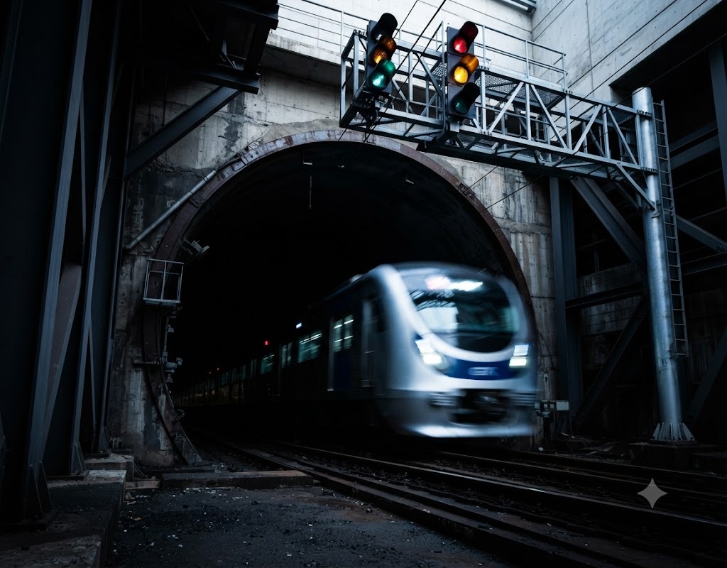
The GTX is not a project to add a single railway line to Gyeonggi-do. It is a project that changes the physical boundaries of living areas—specifically, "where one lives and where one can work" —while shortening travel times between the outskirts of the metropolitan area and major business districts in Seoul by tens of minutes .
According to a 2024 study by the Gyeonggi Research Institute, as of 2019, daily commutes in Gyeonggi Province totaled approximately 5.7 million , the highest in the Seoul metropolitan area; 74.6% of these were internal commutes within Gyeonggi Province, while about 25.5% were inter-regional commutes to Seoul and Incheon. For Gyeonggi residents using public transportation to major business districts in Seoul, the average commute time exceeded one hour in all areas: 84 minutes for Gangnam, 86 minutes for Yeouido, and 87 minutes for the city center. Based on telecommunications data, the figures were 88.8 minutes for Gangnam, 108.6 minutes for Northern Seoul, and 91.7 minutes for Yeouido. Although these figures represent the Historical Official Baseline , they demonstrate that the structural problem the GTX aims to solve is not merely traffic congestion, but the separation of long-distance workplaces and residences within the Seoul metropolitan area. ( Gyeonggi Research Institute )
Reduced travel time on the GTX-A has already become a reality. The travel time from Paju Unjeong Jungang to Seoul Station has been shortened from the previous approximately 54–70 minutes to the 20-minute range, and the actual Unjeong Jungang–Seoul Station section operates in about 21.5 minutes at a maximum speed of 180 km/h. The travel time from Suseo to Dongtan has also been reduced from the previous 75–79 minutes to approximately 19–21 minutes. ( Ministry of Land, Infrastructure and Transport )
Usage demand also increased rapidly. Within 60 days of opening, the Unjeong Jungang-Seoul Station line was used by approximately 2.19 million people , with a daily average of about 36,557; by the end of February 2025, the weekday weekly average had reached 83.4% of the projected demand. Weekday ridership on the Suseo-Dongtan line nearly doubled from 7,734 per day in April 2024 to 15,708 in February 2025. As of April 2025, the cumulative ridership on the Suseo-Dongtan line was approximately 4.1 million, while the Unjeong-Seoul Station line recorded about 3.6 million users within three months of opening. ( Gyeonggi Transport Information Center )
However, it cannot be concluded that the GTX will evenly improve living conditions across the entire Gyeonggi Province. New disparities may arise between areas close to stations and those that are not, between areas with good bus and rail connections to the GTX and those that are not, and between areas where jobs, commerce, and housing are complexly formed around stations and areas that remain simple bedroom communities.
More importantly, it has not yet been determined whether the GTX will reduce or rather strengthen dependence on Seoul .
Significantly reducing travel time from Paju, Uijeongbu, and Dongtan to Seoul will enhance the convenience of life for Gyeonggi-do residents. However, if local jobs and commercial districts are not developed alongside this, it could lead to an even faster migration of consumption and labor from Gyeonggi-do to Seoul.
Therefore, Gyeonggi Province's Golden Time does not lie in securing more GTX lines. The key lies in analyzing data on the movement of people, jobs, consumption, housing, commercial areas, and businesses before and after the opening of the GTX, and whether station areas can be transformed into new regional hubs that combine jobs and living services, rather than merely focusing on housing development .
The problem of long-distance commuting in Gyeonggi-do cannot be explained solely by its relationship with Seoul.
According to an analysis by the Gyeonggi Research Institute, 74.6% of commuting in Gyeonggi Province occurred within the province. This implies that while Gyeonggi Province has already formed one large, independent living area, the travel distances between cities and counties are long. ( Gyeonggi Research Institute )
Seongnam, Suwon, Hwaseong, Yongin, and Pyeongtaek have large-scale job opportunities, while Goyang, Paju, Gimpo, Namyangju, and Uijeongbu have a large commuter population to Seoul. Residential areas and jobs are separated due to differences in housing costs, industry, education, and transportation environments between cities.
GTX compresses this structure.
According to the current official status of Gyeonggi Province's GTX network, Line A consists of a 46.0 km privately funded section from Paju to Samsung and a 39.5 km government-funded section from Samsung to Dongtan. Line B connects Incheon National University Station to Maseok, directly impacting areas within Gyeonggi Province such as Bucheon, Guri, and Namyangju. Line C spans 86.5 km from Deokjeong to Suwon, passing through Yangju, Uijeongbu, Gwacheon, Gunpo, Uiwang, and Suwon. ( Gyeonggi Provincial Government )
Once completed, GTX-A will connect the northwestern and southeastern parts of the Seoul metropolitan area from Paju to Dongtan along a single axis. With the addition of B and C, an ultra-regional mobility axis within Gyeonggi Province will be added to the metropolitan area's existing 'Seoul-centered radial movement. '
Therefore, it is highly likely that Gyeonggi-do living areas will be redefined in the future based on 30-minute and 60-minute travel times rather than administrative boundaries.
The most common illusion regarding the GTX is the linear assumption that "the creation of a station leads to the development of a region."
However, the following must be distinguished.
- GTX opening ≠ regional economic growth
- Station area development ≠ Job increase
- Rising housing prices ≠ Improvement in residents' quality of life
- Improved accessibility to Seoul ≠ Improved regional self-sufficiency
- Reducing train travel time ≠ reducing door-to-door commuting time.
The train itself takes about 20 minutes from Paju Unjeong Jungang to Seoul Station. However, actual commuting time includes the time spent traveling from home to the GTX station, moving to the platform, waiting, and transferring to the final destination after arriving in Seoul.
In fact, following the opening of the GTX-A, the government also connected two Paju-style PBRT lines to Unjeong Jungang Station and improved bus and road connections at Dongtan Station. This is because even if trains become faster, the time-saving effect of the GTX is diminished if the First Mile and Last Mile issues are not resolved . ( Republic of Korea )
The Gyeonggi Research Institute also analyzed that to maximize the effects of the GTX, the key is not only the metropolitan transportation network itself but also an integrated transportation system connecting GTX stations with local transportation.
Therefore, the performance of the GTX should be evaluated based on the residents' actual door-to-door time rather than maximum speed or travel time between stations.
The first change that GTX creates is the temporalization of distance .
Previously, the physical distance of more than 30km between Paju and Seoul was important. With the GTX, actual travel time is reduced to the 20-minute range, making time a more important criterion than distance in people's choices regarding housing and employment.
The second is the expansion of the right to work .
Not only can residents of the outskirts of Gyeonggi Province choose jobs in downtown Seoul, but conversely, it can also become easier for residents of Seoul or northern Gyeonggi to move to jobs in southern Gyeonggi, such as Pangyo, Yongin, and Dongtan.
The third is the reorganization of commercial districts .
If local residents have easier access to Seoul's cultural and consumption facilities, station areas themselves may grow, but there is also a possibility of consumption outflow to existing local commercial districts.
The fourth is the re-evaluation of the housing market .
Even for the same type of housing, locational value can be re-evaluated if travel time to major business districts in Seoul is significantly reduced. However, since there are many variables affecting housing prices, such as interest rates, supply, and policies, the GTX effect should not be considered the sole cause.
The fifth is changes in corporate location .
Companies can also consider areas with improved worker accessibility as new location candidates. If business, R&D, startup, and cultural facilities are integrated into GTX station areas, these areas have the potential to evolve from mere commuting hubs into new job centers.
In other words, the GTX is a transportation innovation and at the same time a Spatial Reorganization .
Some sections of the GTX-A are already in actual operation.
The Suseo-Dongtan section opened in March 2024, and the Unjeong Jungang-Seoul Station section opened in December 2024. Gyeonggi Province's official GTX status report sets a goal of passing through Samsung Station non-stop in 2026 and fully opening the entire line by 2028. Gyeonggi Province's policy document for 2026 also identifies the connection of the disconnected section between Seoul Station and Suseo as a major change for that year. However, as it is difficult to determine the actual start date of operations for this central connection section based solely on official data available as of the reference date, it is left as an item requiring Runtime Verification . ( Gyeonggi Provincial Government )
Regarding GTX-B, the report on the commencement of construction for the privately funded section was submitted in 2025, and the central government's 2026 work plan proposes the start of construction in August 2025 and opening in 2031. However, the Gyeonggi-do status page still lists a target opening date of 2030, resulting in a discrepancy in schedules between official agency data. Therefore, the opening year of Line B must be re-verified based on the latest construction schedule. ( Ministry of Land, Infrastructure and Transport )
The GTX-C project is undergoing even greater schedule fluctuations. In April 2026, the Ministry of Land, Infrastructure and Transport announced that it had resolved the issue regarding the realistic valuation of construction costs, and on August 25, the amendment to the Implementation Agreement passed the Private Investment Project Review Committee. Based on the latest data from the Ministry, the goal is to begin construction in the second half of 2026, following the completion of construction contracts and financing agreements . In other words, the existing plan for opening in 2028 is now at a stage where it needs to be re-evaluated independently of the actual construction schedule. ( Ministry of Land, Infrastructure and Transport )
Therefore, the key to the GTX era is the actual opening runtime rather than the route map .
What GTX aims for is actually closer to a metropolitan area Regional Express Rail than a new urban railway concept.
Even in major metropolitan areas around the world, the effectiveness of express railways is greater when combined with station area land use, transfer systems, and employment hubs, rather than the railway speed itself.
This is also the reason why the Gyeonggi Research Institute emphasized the connection between regional transportation networks and metropolitan hubs simultaneously with the expansion of the GTX while researching the 'Gyeonggi 1-Hour Commuting Zone.' ( Gyeonggi Research Institute )
The characteristic of Gyeonggi-do is its very large scale and the existence of a single massive center called Seoul.
Therefore, if the GTX is successful, Gyeonggi-do residents' access to Seoul will improve dramatically, but conversely, Seoul's centrality for employment, commerce, and culture could be further strengthened.
For this reason, Gyeonggi-do must go beyond the simple goal of being 30 minutes to Seoul and develop into a Polycentric Metropolitan Region where major hubs within Gyeonggi-do are connected to each other within 30 to 60 minutes .
For example, if Paju–Goyang–Seoul–Seongnam–Yongin–Dongtan are connected as a single A-axis, Namyangju/Guri and Bucheon as a B-axis, and Yangju/Uijeongbu and Suwon/Uiwang as a C-axis, industrial, educational, and cultural mobility within Gyeonggi-do could also change.
The true competitiveness of the GTX lies not in trains bound for Seoul, but in whether it can create multi-centered living zones within Gyeonggi-do .
In 2019, the average public transportation commute time for Gyeonggi residents to major business districts in Seoul was approximately 84 to 87 minutes. ( Gyeonggi Research Institute )
With GTX-A, travel times from Unjeong Jungang to Seoul Station have been reduced to approximately 21.5 minutes, and from Suseo to Dongtan to approximately 19–21 minutes. ( Ministry of Land, Infrastructure and Transport )
During the planning phase for full opening, the government projected daily ridership of approximately 270,000 for GTX-A , 270,000 for GTX-B, and 320,000 for GTX-C. This must be distinguished as these are demand forecasts from the planning stage, not actual usage figures. ( Ministry of Land, Infrastructure and Transport )
In contrast, actual demand for early GTX-A passengers increased rapidly. The Unjeong Jungang to Seoul Station route saw approximately 2.19 million passengers during the first 60 days of operation, while the Suseo to Dongtan route rose to a daily weekday average of about 15,708 by February 2025. ( Gyeonggi Transport Information Center )
Connecting these numbers reveals a significant change.
While the reduction in train travel time has already begun to be proven, the extent to which daily life time has been shortened across the entire region has not yet been sufficiently measured.
The next key indicator for the GTX should not be the number of passengers, but the total time from home → arrival at the station → boarding the GTX → transferring → arrival at work.
The first is the gap between rail speed and door-to-door time . Even if the GTX runs for 20 minutes, if it takes 30 minutes to reach the station, changes in the living area are limited.
The second is the accessibility gap between GTX station areas and non-station areas . Even within the same city or county, the difference in time benefits between areas close to the station and outlying areas can be significant.
The third is the gap between transportation accessibility and local self-sufficiency . While access to Seoul becomes faster, if local employment and consumption do not grow, the area may become a bedroom community.
The fourth point is the gap between the opening plan and the actual construction progress . In particular, unlike the existing long-term plan, follow-up procedures for the commencement of construction on GTX-C are still underway as of August 2026. ( Ministry of Land, Infrastructure and Transport )
The fifth is the gap between station area development and existing residents . The possibility that existing merchants or low-income residents will be displaced due to rising land prices and rents resulting from development must also be verified.
Sixth is the spatial gap between the route's beneficiary and non-beneficiary areas . The relative difference in accessibility between areas with high GTX accessibility and parts of northeastern Gyeonggi and the outskirts may actually widen.
What is most needed after the GTX is not railway construction data, but living area data .
By connecting transportation card, telecommunications, bus, railway, and road data, you can check how actual commuting flows change.
By combining this with employment insurance, business, commercial district, housing, and population movement data, it is possible to analyze whether the GTX has merely reduced travel time or is transforming the economic living zones themselves.
In particular, the following structure is required.
Traffic data + Population migration + Businesses + Employment + Consumption + Housing
This data needs to be connected as a time series.
The Gyeonggi Research Institute 's analysis of actual commuting times to major business districts in Seoul using telecommunications data can serve as the basis for this approach.
In the future, a GTX Impact Observatory is needed to compare Before and After for each GTX station .
Only by doing so can the success of station area development projects be evaluated not by the supply of apartments, but by outcomes such as time spent, jobs, commercial areas, population, and transportation .
The most direct benefit of the GTX is time.
The travel time from Paju Unjeong Jungang to Seoul Station has been reduced to approximately 21–22 minutes, and from Dongtan to Suseo is also in the 20-minute range. The rapid increase in actual passengers is strong evidence that residents are tangibly experiencing the value of time savings. ( Republic of Korea )
However, the GTX that residents experience is not just the 20 minutes inside the train.
At Unjeong Jungang Station, two PBRT lines were added following the opening of the GTX, and transfer passages and entrances at Seoul Station and Yeonsinnae Station were improved. Dongtan Station also saw improvements to connecting buses and roads. ( Republic of Korea )
These measures demonstrate that the true living convenience of the GTX is determined by transfers and accessibility .
Changes also occur in companies.
A feasibility study is underway at Paju Unjeong Techno Valley to examine the possibility of installing separate boarding and alighting facilities at the GTX-A depot. This is an attempt to improve accessibility for workers by directly connecting the industrial complex with the GTX. ( Paju City Council )
If the GTX begins to transform the labor market of regional industries, it is directly linked to the future jobs for youth analyzed in No. 006.
The GTX can either reduce or expand the spatial gap in Gyeonggi-do.
The first axis of beneficiaries is Paju/Goyang and Seongnam/Yongin/Hwaseong along the GTX-A. As it is already in operation, time benefits are becoming a reality.
Once GTX-B is completed, Guri, Namyangju, and other areas will be rapidly connected to northeastern Seoul and the city center.
Since GTX-C runs north-south through Gyeonggi Province from Yangju and Uijeongbu to Suwon and Uiwang, it has the potential to significantly change accessibility in northern Gyeonggi.
However, as of August 2026, according to the latest official data, Line C has completed the procedures for amending the implementation agreement and is at a stage aiming to begin construction in the second half of the year. The expected effects of the planned route should not be treated as the same as the effects of its actual opening. ( Ministry of Land, Infrastructure and Transport )
Also, areas without the GTX may feel relatively further away.
For example, if the existing travel time to Seoul for two regions is 80 minutes each, but for only one region it becomes 30 minutes via GTX, the relative accessibility gap expands to 50 minutes even if the absolute travel time for the other region remains the same .
Therefore, Gyeonggi Province's transportation policy cannot be resolved simply by increasing the number of GTX stations.
A Hub-and-Spoke Regional Mobility structure is needed that connects GTX stations with express buses, conventional trains, DRT, and local buses .
The first reason is that this is the first time data on actual changes in living areas can be secured as the GTX-A is already in operation.
Previously, the effects of the GTX were all predictions. From now on, changes in commuting times, population movement, commercial areas, and corporate locations in Paju, Goyang, Seongnam, Yongin, and Hwaseong will be revealed through actual data.
The second reason is that B and C are still in the construction and groundbreaking stages.
The transfer, accessibility, and station area issues identified in Line A can be reflected in the designs and development plans for Lines B and C.
The third reason is that development around GTX stations is set to begin in earnest.
Once station areas have solidified into housing-focused development, adding business, industrial, or cultural functions incurs significantly higher costs.
The fourth reason is that a data foundation capable of analyzing human movement in real time using AI and AX already exists.
Therefore, the period from 2026 to 2028 is a golden time to transform the GTX from a simple transportation facility into Spatial AX Infrastructure that redesigns the living areas of Gyeonggi-do .
12-1. Golden Time Application Case in Basic Local Governments ① — Paju City
Paju is a prime example where the effects of the GTX-A were realized first.
The Unjeong Jungang-Seoul Station line opened on December 28, 2024, and covers approximately 32.3 km in about 21 minutes. This significantly shortens travel time, which previously took an average of about 66 minutes using existing express buses. ( Republic of Korea )
Usage demand also increased rapidly. Approximately 2.19 million people used the service during the 60 days following its opening, and weekday ridership rose to over 83% of projected demand. ( Gyeonggi Transport Information Center )
However, Paju's Golden Time does not end with 'Seoul is getting closer.'
Paju City has reviewed the development of a cultural performance complex near Unjeong Jungang Station and is also investigating the feasibility of linking Unjeong Techno Valley with the GTX train depot's boarding and alighting facilities. This can be seen as an attempt to transform GTX stations from mere commuter stations into hubs for industry, culture, and daily life . ( Paju City Management Corporation )
What needs to be tracked in Paju going forward is not apartment prices.
We need to examine how the cycle of Seoul commuting time → local employment → local consumption → attracting businesses → commercial districts → population settlement unfolds.
The real outcome of the GTX is whether Paju becomes a closer bedroom community to Seoul or grows into an independent northwestern hub city connected to Seoul.
12-2. Golden Time Application Cases in Basic Local Governments ② — Uijeongbu City
Uijeongbu is at the exact opposite stage from Paju.
It is expected that the opening of GTX-C will significantly reduce travel times from Deokjeong and Uijeongbu to the Gangnam area of Seoul. The government's existing planning documents set a goal to shorten the travel time between Deokjeong and Samsung from the current approximately 75 minutes to around 29 minutes . However, this is still an estimated time at the planning stage , not actual operational performance . ( Ministry of Land, Infrastructure and Transport )
The more important latest evidence is from August 25, 2026. The Ministry of Land, Infrastructure and Transport announced that the amendment to the GTX-C implementation agreement has passed the Private Investment Review Committee, and that it aims to begin construction in the second half of 2026 following the signing of construction contracts and financing agreements. ( Ministry of Land, Infrastructure and Transport )
Uijeongbu City is also currently announcing a 60-month project period for the GTX-C and has proposed the commencement of construction in 2026 as its future plan. ( UI4U )
Therefore, Uijeongbu's Golden Time is not waiting for the opening.
It is to first design how to arrange residential, business, AI, youth, and commercial functions in the station area before the GTX arrives .
If the Uijeongbu AI Innovation Cluster analyzed in No. 002 and the Northern Gyeonggi Youth Support Center in No. 006 are connected to GTX-C, Uijeongbu has the potential to develop into an AI, youth, and service hub in Northern Gyeonggi, rather than just a city for commuting to Seoul.
Conversely, if only the housing supply increases after the opening of the GTX, it could become entrenched as a new bedroom community with good access to Seoul.
The first loss is the outflow of GTX effects to Seoul . As residents work and spend more easily in Seoul, local employment and commercial districts may not grow.
The second issue is the concentration of housing around train stations. If the areas surrounding stations are filled with residential zones focused on short-term real estate development profits, there will be insufficient space to create business, cultural, and industrial hubs in the future.
The third is the accessibility gap. Areas far from GTX stations may be relatively marginalized.
The fourth factor is the rising cost of living for existing residents. If land prices and rents in station areas rise rapidly, there is a possibility that existing commercial areas and vulnerable groups will be displaced.
The fifth factor is the expansion of the commuting distance itself. As transportation becomes faster, people can commute from more distant areas. Consequently, while train travel times may decrease, the total daily travel distance could actually increase.
The sixth factor is planning delays. If the actual commencement of construction and opening of Lines B and C are delayed, a time lag may occur between the station area development plan and private investment.
If the GTX is properly utilized, Gyeonggi Province has the potential to develop into a multi-core metropolitan area where several economic and lifestyle centers are connected, rather than just a residential area on the outskirts of Seoul.
Paju can function as a northwestern hub, Goyang as a broadcasting, content, and MICE hub, Seongnam as an AI and IT hub, Yongin and Hwaseong as a semiconductor and high-tech industry hub, Suwon as an administration and R&D hub, and Uijeongbu as a service and AI hub for northern Gyeonggi.
The GTX connects these hubs via Seoul or brings them into a short time zone.
What is needed at this time is not the same development of building apartments at every station.
Depending on the industrial and lifestyle characteristics of each region, station areas should be differentiated into industrial, business, cultural, residential, and transfer station areas .
In addition, areas outside the GTX influence zone must be made into indirect beneficiary zones by connecting intercity buses, DRT, and general railways to the GTX Hub .
By doing this, the benefits of the GTX can be extended beyond a radius of 1 to 2 km of the station to 31 cities and counties.
After the GTX, Gyeonggi- do needs a Metropolitan Living Area Runtime .
Changes to observe | Things to do with AX | Policy decision | Verification indicators |
| Actual commute time | Traffic and communication data analysis | Transfer network adjustment | Door-to-Door time |
| GTX usage | Demand forecast by station and time of day | Increase in frequency and dispatch adjustments | Congestion and waiting times |
| First/Last Mile | Bus and DRT Movement Analysis | Reorganization of connecting routes | Station approach time |
| population migration | Analysis of Inflow and Outflow Patterns | Adjustment of Housing and Living SOC | Net movement |
| Employment mobility | Residence-Workplace Analysis | Promoting local jobs | Work-to-home ratio |
| local commercial district | Card and sales data analysis | Commercial District Support and Development | Sales and Store Changes |
| Station area development | Tracking changes in land and businesses | Mixed-use development | Jobs/Housing Ratio |
| Business location | Business Relocation and Startup Analysis | Designation of industrial hubs | New companies and employment |
| spatial gap | Mapping GTX access times | Supplementing non-beneficiary areas | Accessibility GAP |
| B·C process | Analysis of actual progress rate | Adjustment of station area development speed | Plan-Actual Schedule Gap |
In particular, time-based administrative guidance is needed to go beyond existing railway demand forecasts .
If you overlay data on a 15-minute living area → a 30-minute local living area → a 60-minute metropolitan economic area, a new Gyeonggi-do that was not visible based on administrative boundaries alone may emerge.
Opportunity + Structural Risk
The GTX has actually started to shorten the long-distance commuting time for Gyeonggi residents.
The initial increase in GTX-A ridership and the time savings between Paju and Seoul, and between Dongtan and Suseo, demonstrate that the effects of the GTX are becoming a reality, not merely a plan. ( Ministry of Land, Infrastructure and Transport )
Therefore, the opportunity is very large.
However, this opportunity does not necessarily mean the growth of the Gyeonggi regional economy.
As accessibility to Seoul improves, local consumption and talent may flow out to Seoul more rapidly, and a new spatial gap could emerge between areas around GTX stations and non-station areas.
Furthermore, variability between the original plan and the actual progress has been confirmed for the schedules of Routes B and C. In particular, as of August 2026, Route C is still proceeding with procedures for the commencement of actual construction. ( Ministry of Land, Infrastructure and Transport )
Therefore, the current stage is determined as Opportunity + Structural Risk .
If Gyeonggi Province manages the GTX simply as a commuter railway, it has the potential to further expand the central living area of Seoul; however, if it connects local industries, commercial districts, culture, and residential areas, there is a possibility that Gyeonggi Province itself could be reorganized into a single multi-core metropolitan region.
In future runtime analysis, at least the following evidence must be continuously tracked.
- Average daily passengers by GTX-A station
- Congestion levels by time of day
- Unjeong Jungang to Seoul Actual Door-to-Door Time
- Dongtan to Gangnam Actual Door-to-Door Time
- Average time to reach the GTX station
- Usage of connecting buses and DRT
- Transfer waiting time
- Actual workplaces of GTX users
- Seoul commuter rates before and after opening
- Changes in commuting between cities and counties within Gyeonggi-do
- Net migration of population in GTX station areas
- Housing supply in station areas
- Changes in housing prices and rents
- Existing resident and merchant attrition rate
- Number of businesses in station areas
- New Startups & Company Relocation
- Employment growth rate in station areas
- Changes in regional card sales and consumption
- Changes in local consumption and Seoul consumption
- Ratio of office, commercial, and residential uses in station areas
- GAP between non-station areas and GTX station access times
- GTX-B Actual Construction Rate and Opening Schedule
- GTX-C Actual Construction Start, Progress Rate, and Opening Schedule
- Securing Feasibility and Funding for GTX Extension Project
- Changes in job-housing ratios by region before and after the opening of the GTX
The most significant data gap is that while it is possible to verify how much the GTX has reduced train travel time, there is a lack of public data that connects and shows how it is actually changing residents' daily routines, employment, consumption, and housing choices .
Runtime Chain
GTX opening → Access to stations → Actual commuting time → Reorganization of commuting and movement → Relocation of residence, consumption, and businesses → Changes in station areas → Local employment and commercial districts → Reorganization of living areas → Widening or narrowing of spatial disparities
The first key evidence of this analysis is Gyeonggi-do's existing long-distance commuting structure. The Gyeonggi Institute analyzed that as of 2019, there were approximately 5.7 million daily commutes in Gyeonggi-do, and the average public transportation commute time to major business districts in Seoul significantly exceeded 80 minutes. The GTX is infrastructure designed to change this very structure. ( Gyeonggi Institute )
Gyeonggi Research Institute “Study on Measures to Realize a 1-Hour Commute in Gyeonggi Province”
The second piece of evidence is the actual usage performance of GTX-A. Approximately 2.19 million people used the Unjeong Jungang to Seoul Station route within 60 days of opening, and the number of users on the Suseo to Dongtan route also increased rapidly after the opening. ( Gyeonggi Transport Information Center )
Ministry of Land, Infrastructure and Transport GTX-A Usage Performance Data
The third factor is the change in daily travel time. Based on government data, the Unjeong Jungang to Seoul Station route is structured to be shortened from the existing 54–70 minutes to the approximately 20-minute range, and the Suseo to Dongtan route from about 75–79 minutes to around 19 minutes. Travel times in the 20-minute range are also confirmed on actual operating routes. ( Ministry of Land, Infrastructure and Transport )
The fourth point is that the effectiveness of the GTX is determined by transfer transportation. Following the opening of GTX-A, the government continuously improved the Unjeong Jungang Station PBRT, connecting buses and roads at Dongtan Station, and transfer facilities at Seoul Station and Yeonsinnae. ( Republic of Korea )
The fifth factor is the Schedule Risk for Lines B and C. The target opening year for GTX-B differs between the central government's 2026 work plan and Gyeonggi Province's current status data, while GTX-C is currently at a stage where it aims to begin construction in the second half of the year following the approval of the revised implementation agreement by the Private Investment Review Committee on August 25, 2026. Therefore, past planned opening years should not be used as if they were confirmed outcomes. ( Ministry of Land, Infrastructure and Transport )
Ministry of Land, Infrastructure and Transport GTX-C Latest Progress Status as of August 2026
Structural insights remaining from this analysis
The GTX changes more than just the travel time to Seoul.
It changes the very way people choose cities.
In the past, areas located 60 to 90 minutes away from Seoul were physically distant residential areas. With the advent of the GTX, some areas are now connected to Seoul's central business districts within 20 to 30 minutes.
Then, people can live further away, and companies can recruit talent from a wider area. Consumers can access commercial districts and cultural facilities in other cities, and students can also choose from a broader range of educational opportunities.
In other words, the existing administrative boundaries remain the same, but the boundaries of the actual living area shift.
However, there are two directions to this change.
The first direction is GTX → improved accessibility to Seoul → expansion of employment and consumption in Seoul → Gyeonggi becoming a bedroom community.
The second direction is GTX → improved wide-area accessibility → growth of industry, culture, and business around stations → strengthening multi-centered living zones within Gyeonggi.
all.
The railway does not decide which direction to go.
It determines how the area around the station is developed, what businesses and jobs are created, and how local transportation is connected.
Therefore, the indicators Gyeonggi Province needs to look at in the GTX era must also change.
While previously we looked at route length, completion rate, number of stations, and passengers, going forward we must consider door-to-door time, work-housing costs, local consumption, new jobs, corporate locations, and spatial disparities.
In particular, if you only track real estate prices after the opening of the GTX, you miss the most important aspect of the changes in the living area.
What Gyeonggi Province needs to gain is not rising housing prices, but the time of its residents .
If a daily round-trip commute is reduced by 40 minutes, hundreds of hours are returned to an individual over the course of a year. If that time is redirected to family, learning, consumption, leisure, entrepreneurship, or local activities, the social impact of the GTX can be much greater than simple transportation benefits.
Conversely, if the GTX forces people to move further away, increasing their commute distance and weakening local commercial areas, it cannot be said that while the trains have become faster, life has necessarily improved.
This is also directly connected to the future jobs for youth analyzed in No. 006. The GTX expands the range of labor markets accessible to young people. However, if there are not enough future jobs within Gyeonggi Province, it may ultimately remain merely a means to access Seoul's job market more quickly.
Therefore, the key thing Gyeonggi Province needs to manage after the GTX is not the Railway, but the Living Area .
Golden Time Thesis — The golden time for Gyeonggi-do after the GTX is not a time to compete over how many minutes it takes to get to Seoul, but a time to connect the reduced travel time within the next two to three years with local jobs, commercial districts, culture, and housing to create a 'multi-core living area where one can work, live, and consume within Gyeonggi-do,' rather than a 'Gyeonggi-do that gets to Seoul faster.'
Version | Reference Date/Revision Date | Major changes |
| v1.0 | 2026.08.28 | This study provides the first analysis of the reorganization of Gyeonggi-do’s metropolitan living areas following the GTX. It examines Gyeonggi-do’s long-distance commuting structure, actual utilization performance and commute time reduction of GTX-A, First/Last Mile trends, potential changes in station areas, employment, and commercial districts, and the construction and schedule risks of GTX-B and C. Based on the cases of Paju and Uijeongbu, it determines the "Golden Time" as Opportunity + Structural Risk, citing Metropolitan Living Area Runtime and the necessity of establishing multi-core living areas. |
